|
<< Click to Display Table of Contents >> Trackmap |
  
|
|
<< Click to Display Table of Contents >> Trackmap |
  
|
The track map (Trackmap) is to display the geographic location data of different time nodes in the same chart by adding a time dimension. In addition to the time dimension, it usually includes several latitude and longitude position points.
❖Create a Trackmap
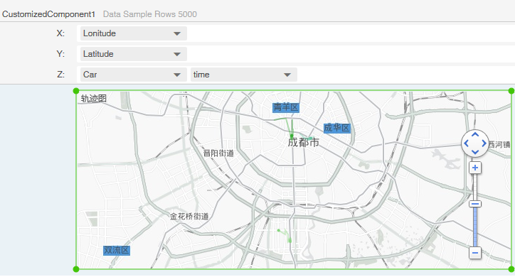
To create a trajectory map, drag the trajectory map component to the report editing area in the component of the right pane, and bind the corresponding data according to the prompt of the binding area. As shown in the following figure, the three groups are different according to the change of time. The trajectory of the vehicle.

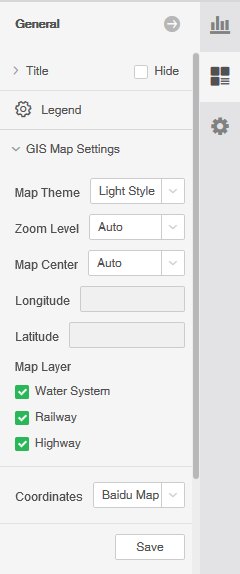
After creating the track map, you can set the gis map style and other information on the right pane, as shown below:
