|
<< Click to Display Table of Contents >> GISMap |
  
|
|
<< Click to Display Table of Contents >> GISMap |
  
|
With the introduction of Baidu maps, users can analyze linkage data on GIS maps.
The data types and rendering methods of GIS maps are the same as those of autonomous maps, and they support custom large-area display.
❖Create GISMap
1.Latitude and longitude positioning
Latitude and longitude The received field type is a numeric type field under the dimension and metrics catalog.
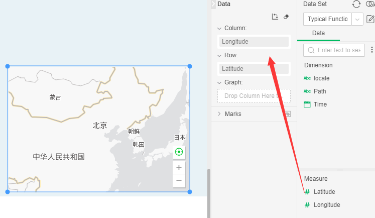
2.Landmark location
The field type received by the landmark line is a string type. When the field is bound at the landmark, the field must be converted to a map column before binding.
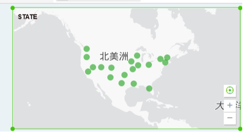
•Reset Geography: When the user interacts with the map, this function restores the GIS display data to the default open state.
•Zoom in and zoom out (button, mouse wheel): Use the buttons to zoom in and out of the map layer by layer; zoom in or zoom out of the map by scrolling the mouse wheel. This button is only used in preview and DB Viewer and is not available in DB Editor.
•Pan: Click the left mouse button to drag the image so that the map bottom map moves within the display area. This button is only used in preview and DB Viewer and is not available in DB Editor.
•Frame selection: Select multiple data by mouse rectangle selection.
❖Configure GIS map style
Support for configuring a variety of GIS servers, including Baidu maps, high-tech maps and Google Maps, you can select servers as needed. Before switching, you need to configure related parameters in the bi.properties file,The key of each server needs to be applied to the corresponding server official website:
a, chart.gis.category=bmap, amap, gmap, heremap, meaning the server type supported by the system, respectively corresponding to Baidu server, Gaode server, Google server,Here map server
b, chart.baidu.ak= Baidu map apk KEY
c, chart.gaode.map.key= KEY map of Gaode map apk
d, chart.google.map.key= google map apk KEY
e, chart.here.map.key=Here map apk KEY
The above several server KEYs need to apply to their respective developer platform websites.
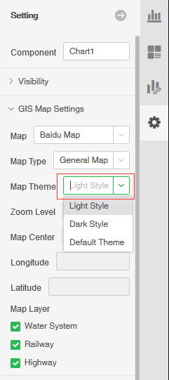
Switching the server can be done in the GIS map settings on the right pane, as shown below:
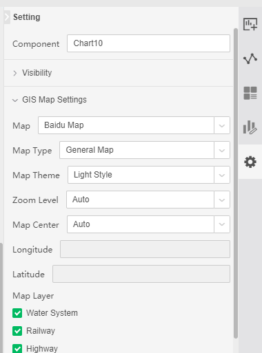
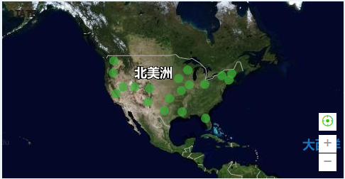
The system provides two map types, satellite maps and general maps. The theme of the general map is divided into light theme and dark theme. At the same time, the geographical layer selection is also included, including: water system, railway, high-speed and national roads.
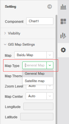
The satellite map is shown below:
The theme of the ordinary map is divided into a light theme and a dark theme:
❖GIS Map Rendering
The GIS map rendering type is the same as the map, supporting point rendering, area rendering, migration rendering, and thermal rendering. Reference map - rendering type.
❖GIS Map Drill
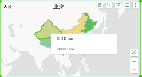
The GIS map is drilled like the map. After the user binds the fields with the hierarchy, you can drill or drill down by right-clicking on the map. The following figure shows:
❖GIS offline map
GIS maps support downloading offline maps to the local, so you can use GIS maps without network.
To use offline maps, you need to first download the map data of the map range you need to use the map download tool to the local, and download the map tool to select the Air Map Assistant.
After downloading the map data, you need to put the map file in an available server container. For example, you can use the tomcat container that comes with YongHong products, then put the map file under the websapp folder of tomcat, then the URL to access the map file is: http\://localhost\:8801/offlinemap. The 8801 is the service port of the tomcat, and the offlinemap is the name of the folder where the map file is located.
Then in the bi.properties configuration file in the YongHong product directory, the configuration parameter: “chart.offline.path=”, the value of the parameter, configured as the URL just obtained. At this point, the necessary configuration is completed, and the GIS map component is added when the dashboard is created, and the downloaded offline map data is used.
have to be aware of is:
1. When using the offline map, the downloaded map data needs to cover all the data of the map column used when the dashboard is fully created. Otherwise, the place where the GIS map does not acquire the data will be displayed as a white screen.
2. The current product only supports Baidu map, so download the map data of Baidu map when downloading.
3. Offline map data download tool, you can use "XSnode v1.0.14".